With temps warming up starting Wednesday, this may be the last chance to see the epic Sierra snowpack in its entirety from space.
A string of atmospheric rivers and unusually cold temperatures last winter left an enormous snowpack in the mountains the likes not seen in California for decades.
The Moderate Resolution Imaging Spectroradiometer (MODIS) on NASA’s Terra satellite captured the snowcover on April 6 (see above).
Beautiful snow cover observed along the Sierra Nevada Mountain Range. Seen yesterday by SNPP VIIRS. pic.twitter.com/tL565anl3m
— CIRA (@CIRA_CSU) April 25, 2023
With temperatures ramping up as high as the mid-90s in the Bay Area by the end of the week, experts are expecting “the Big Melt.” For example, Yosemite National Park will close from Friday through next Wednesday due to flood risk.
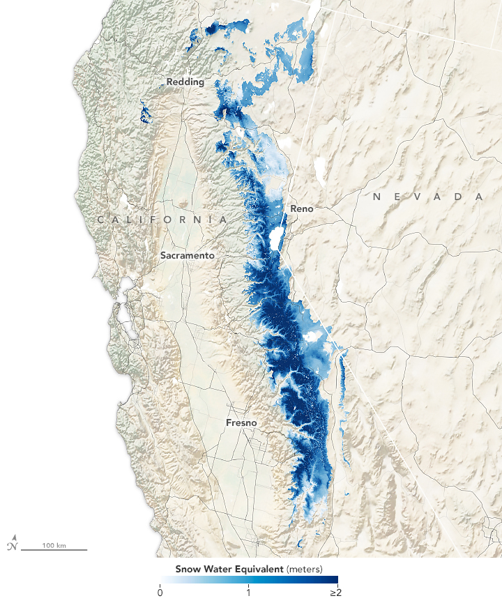
A map from the Institute of Arctic and Alpine Research (INSTAAR) shows snow water equivalent (SWE) — a measurement of how much water you would get if all of the snow in a given area melted at once. In the southern Sierras, the measurement was four times as high as the average for April 1.